Jul 31, 2008

Instituto Technolóico y de Estudios Superiores de Monterrey - Campus Guadalajarahttp://www.ccm.itesm.mx/dia2007/bienvarq.htmlhttp://cmportal.itesm.mx/wps/portal/!ut/p/kcxml/04_Sj9SPykssy0xPLMnMz0vM0Y_QjzKLN4i3dAHJgFjGpvqRqCKOcAFvfV-P_NxU_QD9gtzQiHJHRUUA43OWZA!!/delta/base64xml/L0lDU0lKQ1RPN29na2tBISEvb0lvUUFBSVFnakZJQUFRaENFSVFqR0EhLzRKRmlDbzBlaDFpY29uUVZHaGQtLzdfMF9DTQ!!?WCM_PORTLET=PC_7_0_CM_WCM&WCM_GLOBAL_CONTEXT=http://cmpublish.itesm.mx/wps/wcm/connect/ITESM/Aspirantes/Profesional/Carreras+profesionales/Ingenier%C3%ADa+y+Arquitectura/ARQshapeimage_31_link_0
Instituto Tecnológico y de Estudios Superiores de Monterrey - Campus Ciudad de Mexicohttp://www.ccm.itesm.mx/dia2007/bienvarq.htmlhttp://www.ccm.itesm.mx/dia2007/bienvarq.htmlshapeimage_32_link_0
John H. Pilling Home../John_H_Pilling/about_JHP.html

BAC Instructors:

Luis Montalvo John Pilling

JHP Academics Home../John_H_Pilling/academic-courses-studios.html

Designing Together - A Parallel Studio about Living in the Américas

Program and Site

Travel ObservationsSteven-Berger.htmlChristian-Bender.htmlshapeimage_37_link_0

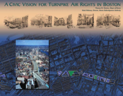
BRA Design Guidelines for Turnpike parcels - including parcel 7 - click on image to open a .pdf copy of the 63 page document

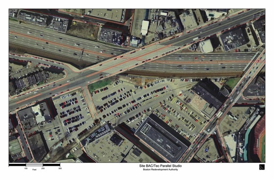
Aerial view of site.  Click on image to open a .jpg file of it

Site Area: Approximately 380,000 SF / 38,000 SM


Program Information:

Housing, Ground Level Retail, Parking, Transit Station / Public Open Space

Housing:

200 to 300 units with an assumed average size of 800 SF / 80 SM

Retail:

43,000 - 64,000 SF / 4300 - 6400 SM on ground floor of 5 to 6 story buildings

Transit / Plaza

Defined more by open space than transit needs - 1200 foot / 370 M rail platform, 400 foot / 123 M transit platform for urban ring,

Parking:

200 to 300 parking spaces for new residential

800 minimum replacement spaces for existing

0 to 400 parking space for growth

Total 1,000 to 1,500 space

click to open a .pdf format file showing building footprints (note that some information about railroad is out of date - refer to aerial photograph for most up to date information).Program-and-Site_files/Building%20Footprints.pdf
click to open a .pdf format file showing topography (note that some information about the railroad is out of date - refer to aerial photograph for most up to date information).Program-and-Site_files/Topography.pdf